Historical Data
Agricultural drought occurs when crop yields are below normal due to a prolonged lack of soil moisture in the root zone caused by less-than-normal rainfall (Vyas et al., 2015).
Three remote sensing products were used in this study: NDVI, precipitation, and soil moisture, which reflect, respectively, the intensity of vegetation and the main soil water supply during the growing season.
Agricultural drought was monitored and predicted using a modified Combined Deficit Index (mCDI) based on the monthly deficit of NDVI, precipitation, and soil moisture.
All data presented on this page is available via WMS Server: http://gis.erkin.us/geoserver/drought/wms
Legend
mCDI
Drought Conditions
Mountains
Altitude m
Drought Conditions
Mountains
Altitude m
NDVI
Monthly Average
Monthly Average
Precipitation
Monthly Average, mm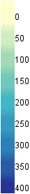
Monthly Average, mm
Soil Moisture
Monthly Average, mm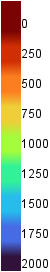
Monthly Average, mm